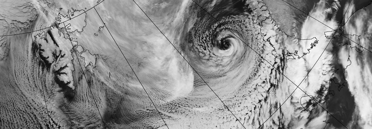

This is an interesting case because I think Spitsbergen has an influence on the development. The elongated cloud stretching down from Spitsbergen’s north-west corner separates the cold Greenland air on the left from the warmer air on the right. The southern edge of the front starts twisting as it gets far enough south, and this is when the polar low starts developing. There is another development just to the east of the incipient polar low. The whiter shades of this second cloud indicates deep convection and high clouds. I’m going to try to find out just what happened in this case. I’ve seen quite a few of this kind of polar low, and it would be fun to see just how much Spitsbergen influences their developments.
Erik
